89 WALNUT ST 89-5
Owner Information
NG DEREK LAI
89 WALNUT ST 89-5
NEWTON, MA 02460


Property Details
89 WALNUT ST 89-5 is classified as a Residential Condominium (Condominium).
The primary structure on this property was built in 1970. There are 874ft2 of built area within this property. There is 874ft2 of residential/living space within this property. This property is listed as having 5 rooms.
89 WALNUT ST 89-5 is valued at $360,000. The land is valued at $0 and the structures are valued at $360,000.
This property is in Zone MR2. Confirm with local Zoning Board authorities to ensure there are no overlays or other easements on this property.
The most recent deed for 89 WALNUT ST 89-5 is recorded at the local registrar in Book 63094, Page 22. 89 WALNUT ST 89-5 was last sold on Friday, December 20, 2013 for $318,000.
Assessment data from fiscal year 2022.
Flood Data
According to the FEMA National Flood Hazard Layer, this property does not appear to be in a flood zone. It may also be in an area not yet reviewed. Nonetheless, confirm this information prior to taking any action.
To view the flood hazards around this property, create a FEMA "Firmette" Map of the area around 89 WALNUT ST 89-5.
Broadband Internet Providers
| Provider | Type | Bandwidth (mbps) | |
|---|---|---|---|
| Viasat Inc | Satellite | 100 | 3 |
| VSAT Systems, LLC. | Satellite | 2 | 1 |
| RCN | Cable | 1000 | 20 |
| GCI Communication Corp. | Satellite | 0 | 0 |
| HughesNet | Satellite | 25 | 3 |
| RCN | Cable | 500 | 20 |
| Comcast | Cable | 1000 | 35 |
| Verizon New England Inc. | Fiber | 940 | 880 |
| Verizon New England Inc. | DSL | 10 | 1 |
Broadband service provider data from December 2020.
Adjacent Properties
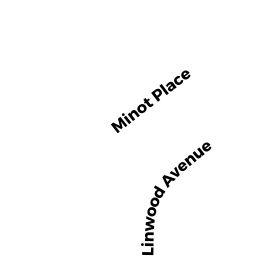
- 340 LINWOOD AVE 1
Residential Condominium owned by RICHARDSON ASHLEY - 340 LINWOOD AVE 2
Residential Condominium owned by RENNEKER KARL M & KRISTEN L - 340 LINWOOD AVE 3
Residential Condominium owned by SUPEYEVA DURAN HANNA - 340 LINWOOD AVE
Other, Open Space owned by 340 LINWOOD AVE MASTER DEED - 67 WALNUT ST
Developable Residential Land owned by 60 WOODBINE ST LLC - 14 BACON RD
Single Family Residential owned by KADDEN JONATHAN S - 364 LINWOOD AVE #364
Residential Condominium owned by TODRES ELLEN - 364 LINWOOD AVE #366
Residential Condominium owned by GATELY RAQUELLE MESHOLAM - 364 LINWOOD AVE
Other, Open Space owned by 364 LINWOOD AVE MASTER DEED - 350 LINWOOD AVE
Single Family Residential owned by SAVOIE JEAN MARIE TR - 356 LINWOOD AVE
Single Family Residential owned by MCDONALD KATHLEEN M & DAVID J - 360 LINWOOD AVE 1
Residential Condominium owned by ZOU YIXIAO - 360 LINWOOD AVE 2
Residential Condominium owned by BECAM MICHAEL & SUSAN E - 360 LINWOOD AVE
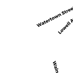
Other, Open Space owned by 360 LINWOOD AVE MASTER DEED - 611 WATERTOWN ST 611-01
Residential Condominium owned by HEILPERN ANDREW J - 611 WATERTOWN ST 611-02
Residential Condominium owned by SATZ RANDI - 621 WATERTOWN ST 621-27
Residential Condominium owned by KUO HAN CHENG TR - 611 WATERTOWN ST 611-03
Residential Condominium owned by TSAI ROGER - 611 WATERTOWN ST 611-04
Residential Condominium owned by LEVINE JEFFREY S & SHAWNA K - 621 WATERTOWN ST 621-24
Residential Condominium owned by SANDLER MERLE - 621 WATERTOWN ST 621-25
Residential Condominium owned by MALTSEV DIMITRY V TR - 621 WATERTOWN ST 621-26
Residential Condominium owned by PILZER OODI - 611 WATERTOWN ST 611-05
Residential Condominium owned by WOLF INVESTORS LLC - 611 WATERTOWN ST 611-07
Residential Condominium owned by ANTOLICK ANN - 611 WATERTOWN ST 611-08
Residential Condominium owned by ROCHE MARK W - 611 WATERTOWN ST #611-9
Residential Condominium owned by PELLEGRINI MARIO - 611 WATERTOWN ST 611-10
Residential Condominium owned by BABAKHANOV ALLA - 611 WATERTOWN ST 611-11
Residential Condominium owned by SAN DONATO LLC - 611 WATERTOWN ST 611-12
Residential Condominium owned by ALKHAZOVA IRINA V - 611 WATERTOWN ST #13
Residential Condominium owned by HE DEGUANG - 611 WATERTOWN ST 611-14
Residential Condominium owned by ARNOLDY MALA J & RALPH - 611-621 WATERTOWN ST
Other, Open Space owned by 611-621 WATERTOWN ST MASTER DEED - 611 WATERTOWN ST 611-15
Residential Condominium owned by PERRAULT BERNADETTE C - 621 WATERTOWN ST 621-16
Residential Condominium owned by DUFFY JEANIE I - 621 WATERTOWN ST #17
Residential Condominium owned by WOLF INVESTORS LLC - 621 WATERTOWN ST 621-18
Residential Condominium owned by AKER ARCHER JESSICA L - 621 WATERTOWN ST #20
Residential Condominium owned by BLYUM ALEKSANDR B & NATALYA V - 621 WATERTOWN ST 621-21
Residential Condominium owned by GILBERT JANE L TR - 621 WATERTOWN ST 621-22
Residential Condominium owned by HANG XING - 611 WATERTOWN ST 611-06
Residential Condominium owned by KAMINSKY ALICE TR - 621 WATERTOWN ST 621-19
Residential Condominium owned by WOLF INVESTORS LLC - 621 WATERTOWN ST #23
Residential Condominium owned by GOEHRING THOMAS M